Ctrl+K
PolarToolkit Logo - Homepage

🚀 Getting started

  • Overview
  • Install
  • Quickstart
  • Citing PolarToolkit

đŸšļ Tutorials

  • Tutorials
    • 1. Download polar data
    • 2. Specify download parameters
    • 3. Create a simple map
    • 4. Add map features
    • 5. Create subplots
    • 6. 3D plots
    • 7. Plotting point data
    • 8. Create a cross-section and profile
    • 9. Interactively explore data
    • 10. Reproject your data

📚 How-To Guides

  • How-To Guides
    • Download NASA datasets
    • Basemaps
    • Switch between hemispheres
    • Defining geographic regions
    • Manipulating geographic regions
    • Adding map features
    • Use with PyGMT
    • Choosing a colorscale
    • 3D stack of grids
    • Extract and plot data along a profile

📂 Available datasets

  • Antarctica
    • Bedmap2 Grids
    • Bedmap3 Grids
    • Bedmachine Grids
    • Deepbedmap Bed Topography
    • ETOPO1 Surface Topography
    • REMA surface elevations
    • IBCSO v2 surface and bed elevation
    • Geoid Anomaly Grid
    • Bedmap Point Data
    • IBCSO v2 data coverage
    • Moho Models
    • Crustal Thickness Grids
    • Sediment Thickness
    • Landsat Image Mosaic of Antarctica (LIMA)
    • MODIS MOA
    • Gravity
    • Magnetics
    • Geothermal Heat Flux
    • Glacial Isostatic Adjustment
    • Ice Velocity
    • Mass Change
    • Ice shelf buttressing
    • Groundingline locations
    • Antarctic Boundaries from MEaSUREs
    • Geologic information
  • Greenland and the Arctic
    • Bedmachine Grids
    • Geoid Anomaly Grid
    • ETOPO1 Surface Topography
    • MODIS MOG
    • Gravity
    • Magnetics
    • Mass Change
    • Ice Velocity
    • Groundingline locations

📖 API

  • polartoolkit package

â„šī¸ Other resources

  • How to contribute
  • Changelog
  • References
  • Source code on GitHub
  • Repository
  • Suggest edit
  • Open issue
  • .md

Greenland and the Arctic

Contents

  • Topography-related data
  • Imagery
  • Geophysical data
  • Geophysically-derived data
  • Shapefiles and Misc.

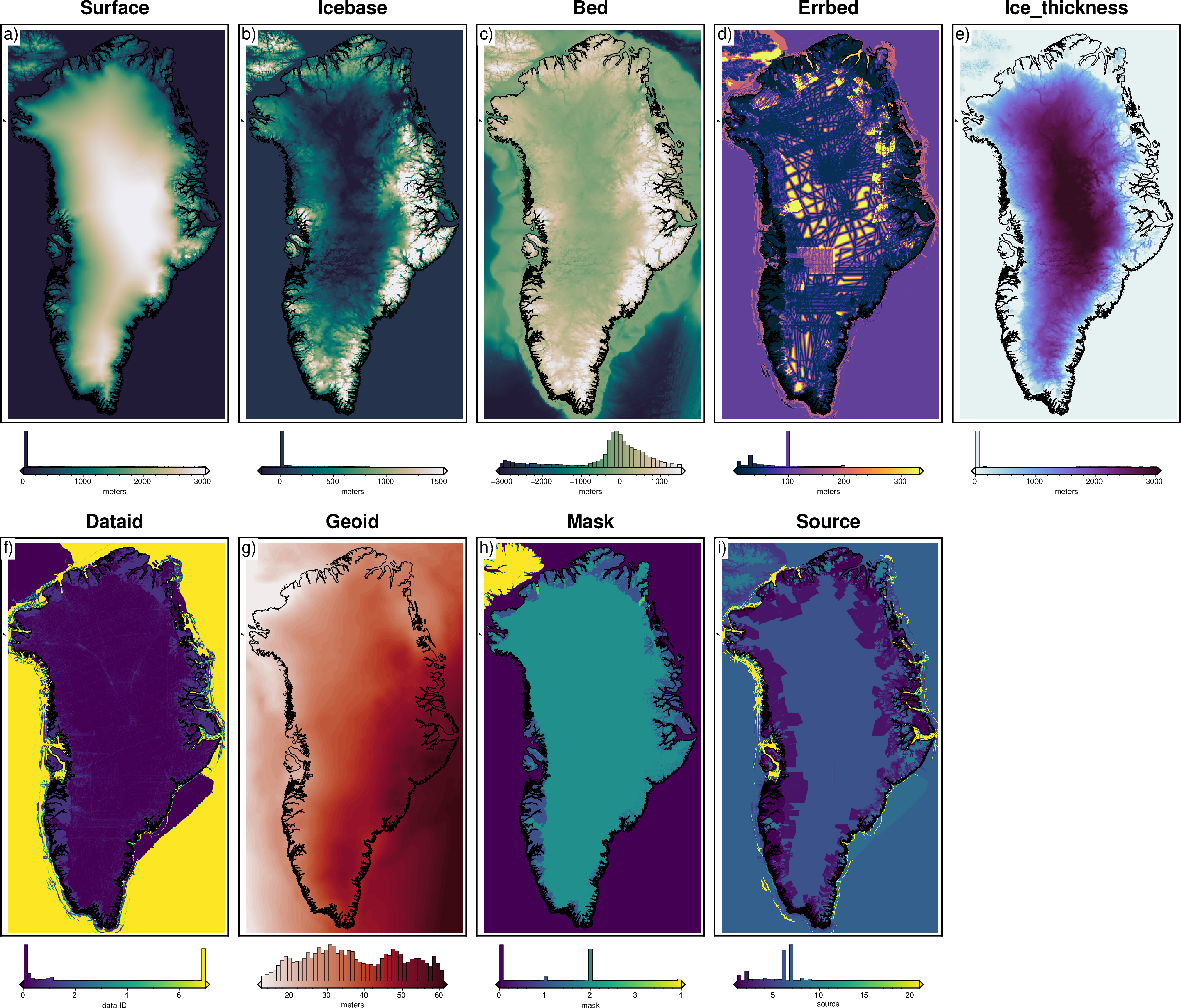
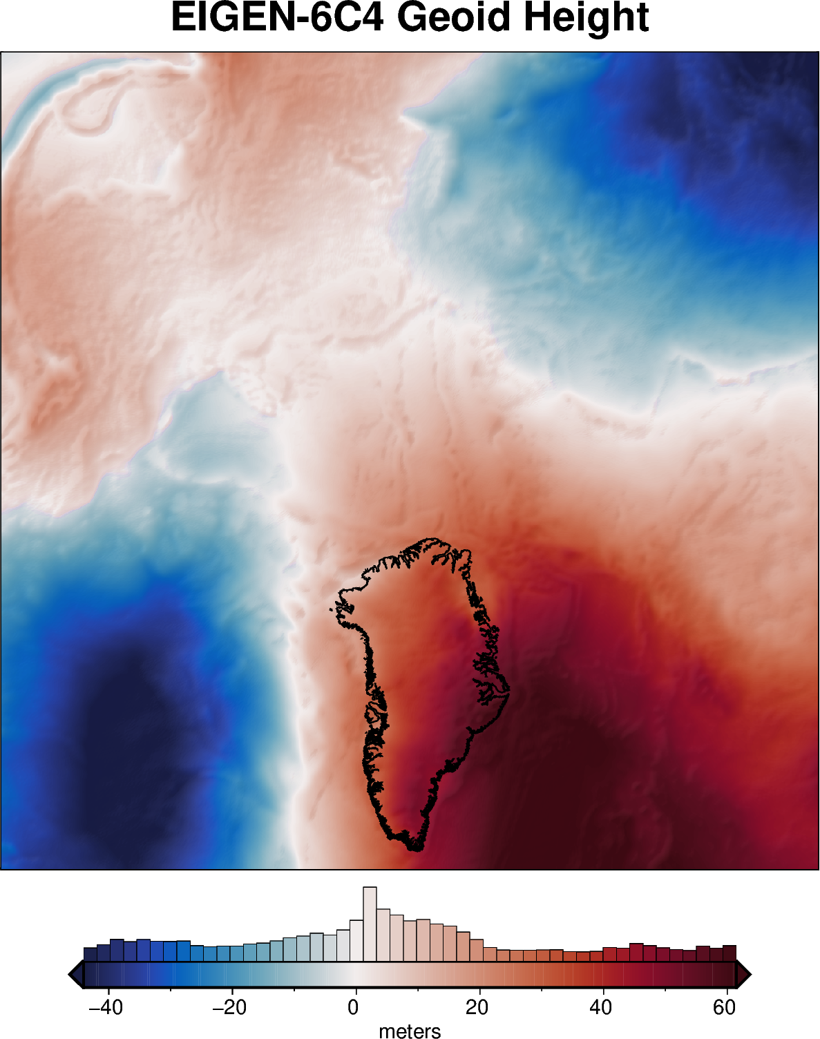
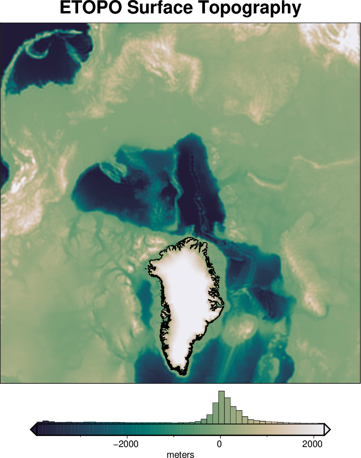
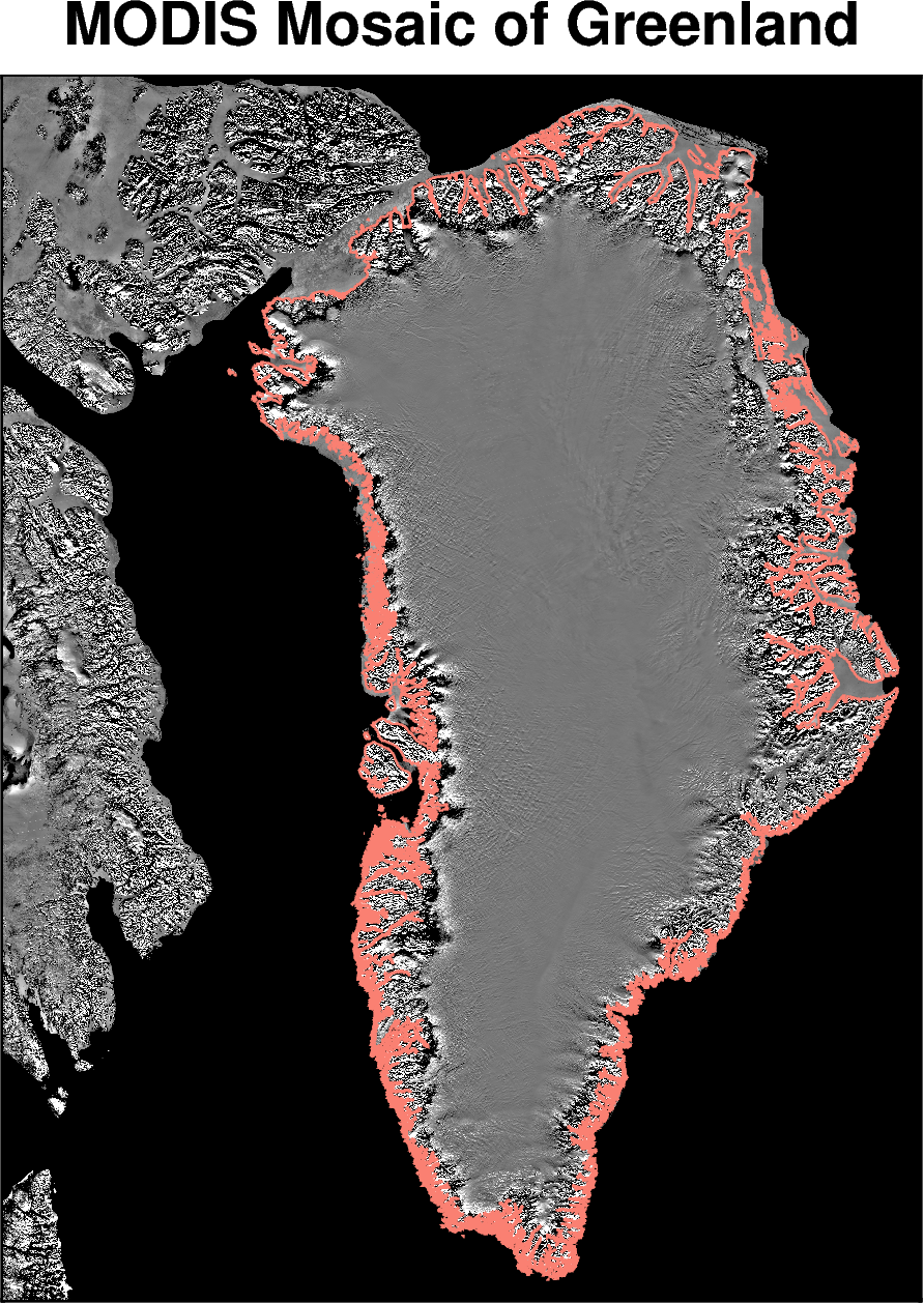
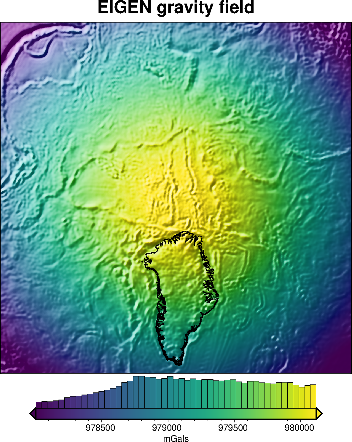
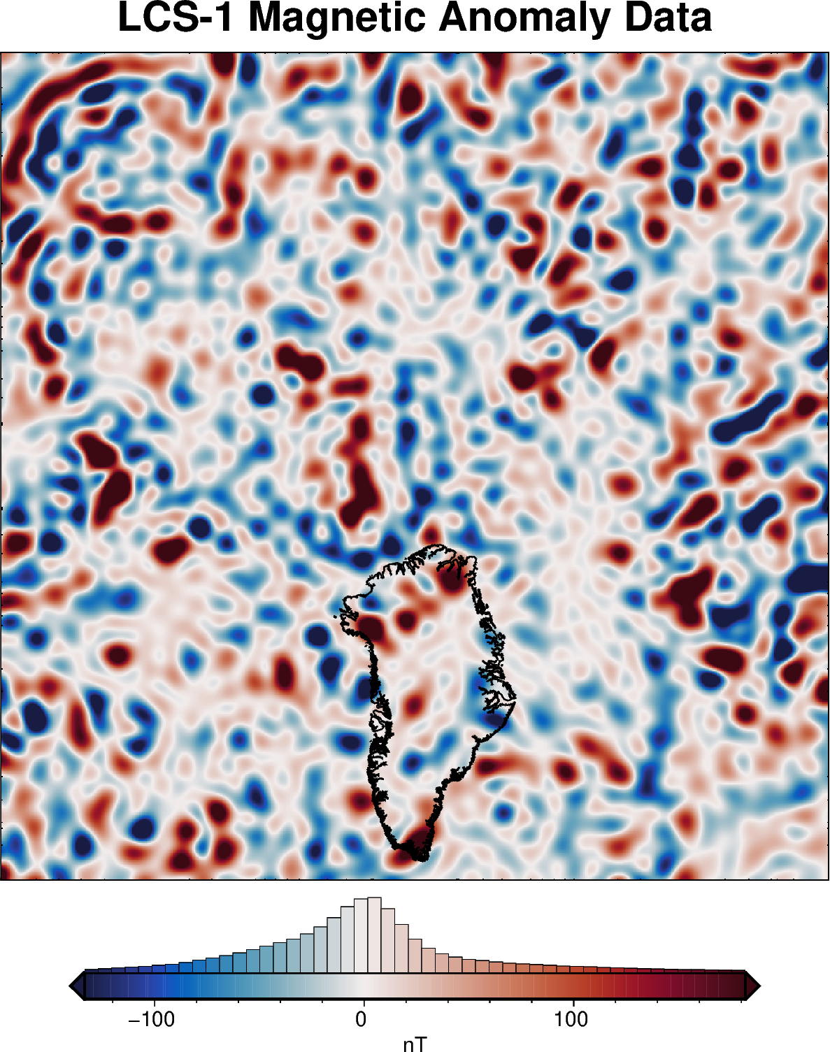
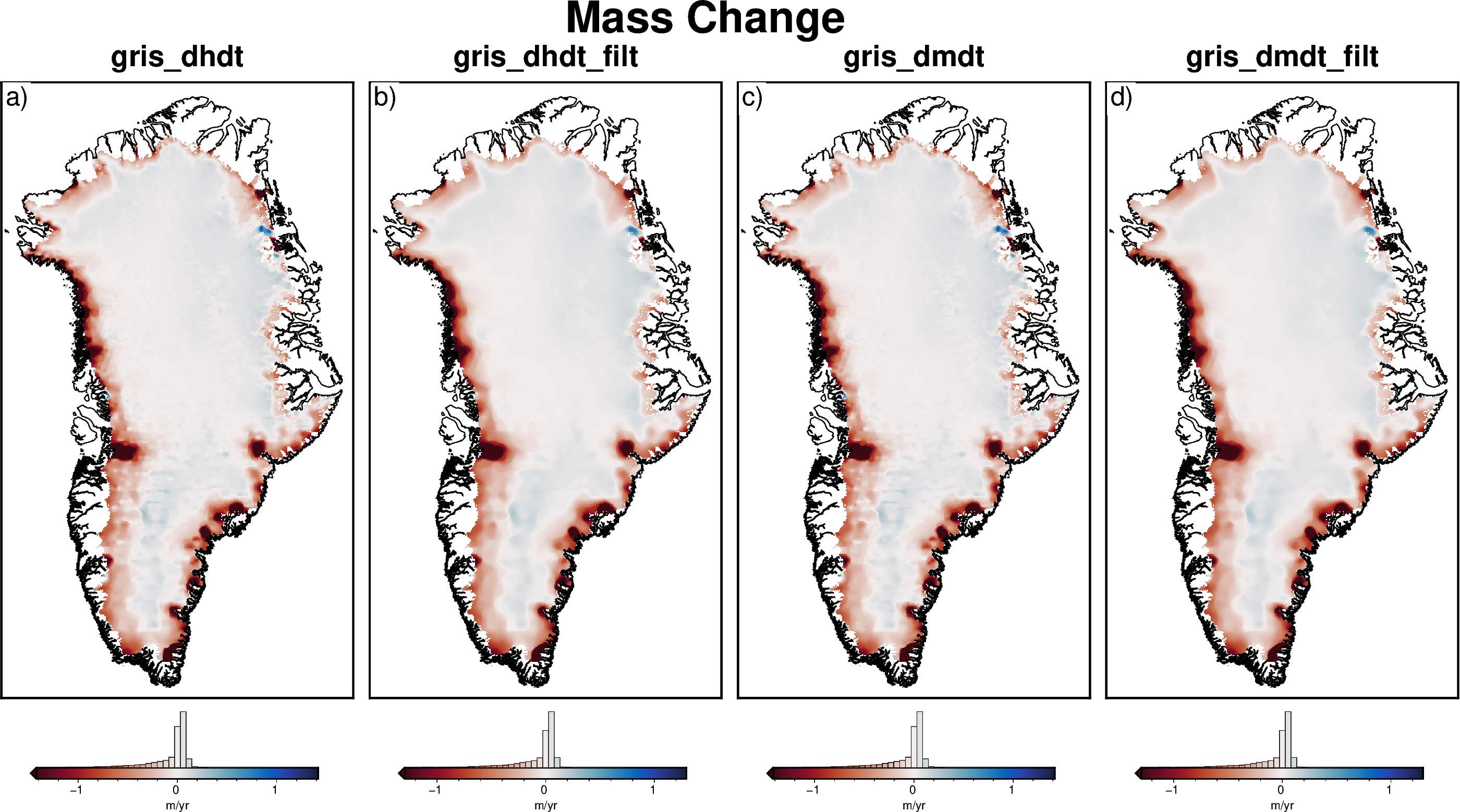
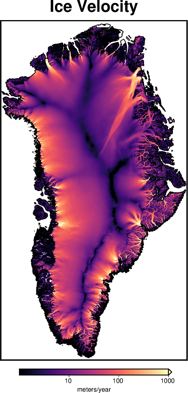
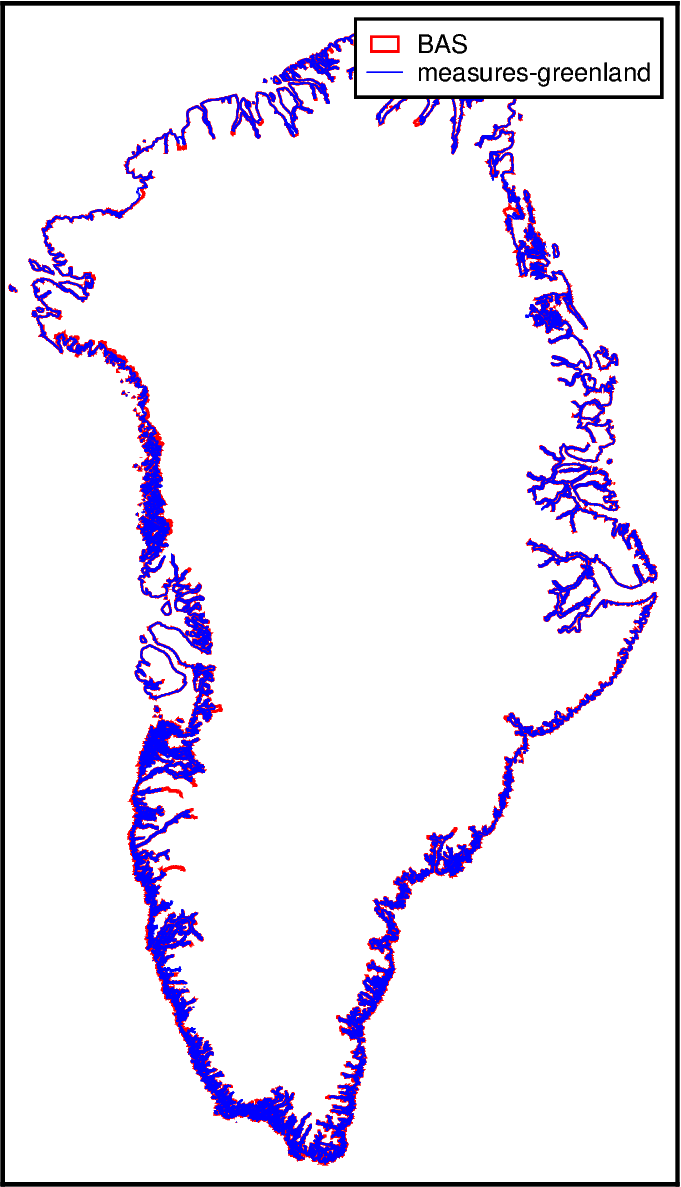
Greenland and the Arctic#

Topography-related data#

Bedmachine Grids
Geoid Anomaly Grid
ETOPO1 Surface Topography

Imagery#

MODIS MOG

Geophysical data#

Gravity
Magnetics

Geophysically-derived data#

Mass Change
Ice Velocity

Shapefiles and Misc.#

Groundingline locations

previous

Geologic information

next

Bedmachine Grids

Contents
  • Topography-related data
  • Imagery
  • Geophysical data
  • Geophysically-derived data
  • Shapefiles and Misc.

By Matt Tankersley

Last updated on Jan 09, 2026.